Topographical survey
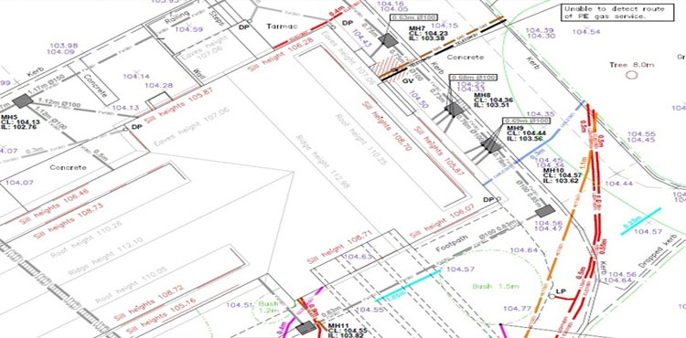
Survey project is typically executed by establishing precise network of primary survey control points covering the entire project area using most precise GPS receivers. This network of primary control points may be further densities by fixing series of secondary control points using DGPS or Total Station depending upon the size of the project.
Levels of survey control points established by GPS or Total Station Traverse are usually not accurate enough and needs to be connected to National Reference Bench Mark to assign accurate Mean Sea Level to each control point using Digital levels. Based on precise grid coordinates of primary and secondary survey control points, detailed topographical survey is conducted by picking x, y and z coordinates of all ground objects in the project area with predefined feature codes using Total Station having automatic data recording devices.Contrary to popular belief,
It has roots in a piece of classical Latin literature from 45 BC, making it over 2000 years old. Richard McClintock, a Latin professor at Hampden-Sydney College in Virginia, looked up one of the more obscure Latin words, consectetur, from a Lorem Ipsum passage, and going through the cites of the word in classical literature, discovered the undoubtable source.
Quick Links
- Our Visit us on Indiamart
- Visit us on Linkedin
- Visit us on our Youtube Channel
- Visit us on our Twitter handle
Contact Us
+91 9810098646 +91 8285034311We consistently apply unique approaches using the latest technologies to provide quality and timely services, no matter the size of the project. Our licensed professionals and skilled technicians serve a diverse client base
Contact Us